
High in the arctic, on a small cluster of Norwegian islands known as Svalbard, hundreds of white domes rise up from the flat, bare landscape. Some of these structures are more than 13 meters (43 feet) across. All together, they house more than 120 antennas, which track hundreds of satellites orbiting Earth. These antennas form the heart of the Svalbard Satellite Station, known as SvalSat. They allow vital data to be transmitted from the satellites to scientists back on Earth.
Many of the satellites monitored by SvalSat collect detailed observations of Earth’s atmosphere, land, and seas for organizations like NASA, the U.S. National Oceanic and Atmospheric Administration, and the European Space Agency. These measurements and images are critical to understanding the growing effects of climate change on Earth and its inhabitants.
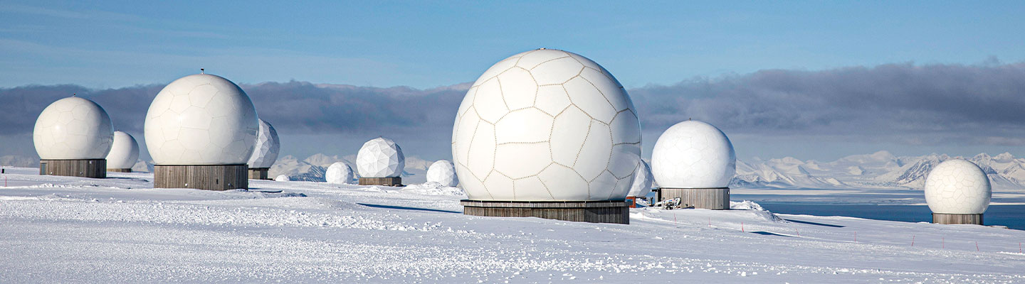
High in the Arctic, hundreds of white domes rise up from the flat, bare landscape. They’re on a small group of Norwegian islands known as Svalbard. Some of these domes are more than 13 meters (43 feet) across. Together, they house more than 120 antennas. These antennas track hundreds of satellites that orbit Earth. This is the Svalbard Satellite Station, known as SvalSat. Its antennas allow important data to be transmitted from the satellites to scientists on Earth.
SvalSat tracks many satellites that collect detailed data on Earth’s atmosphere, land, and seas. Organizations like NASA, the U.S. National Oceanic and Atmospheric Administration, and the European Space Agency use this data. Scientists need these measurements and images to understand the growing effects of climate change on Earth and its population.