
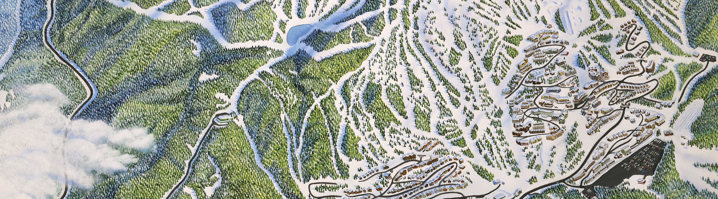
Before skiers and snowboarders hit the slopes, they need to know what routes they can take down a mountain. Parks and resorts rely on ski maps to provide this information to visitors. These maps show a mountain’s topography—the arrangement of an area’s natural features—including slopes, cliffs, and forests. Along with needing to be detailed and accurate, ski maps must look visually appealing to entice people to explore the mountain.
That’s where Rad Smith comes in. He’s an artist and designer specializing in cartography, or mapmaking. He uses geographic data to craft maps that chart ski routes while also highlighting mountains’ breathtaking terrain and surrounding landscapes. Science World spoke with Smith to find out how he creates maps that are both informative and beautiful.